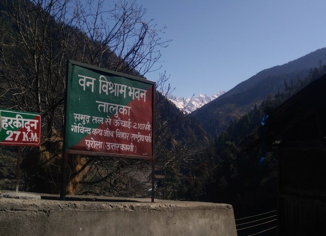
It was around 11 AM when we all gathered in Taluka to start out trek. Many of us had read about the trek through various blog and were boasting about the beautiful meadows, farms, the calmly flowing river, snow clad mountains, others were all thrilled to start the trek and experience those moments. It would take us 3 days to reach at the valley covering a distance of total 27 km from Taluka. Our first pit-stop was at Puani Garaat around 13 km from Taluka which would take us around 6-7 hours.
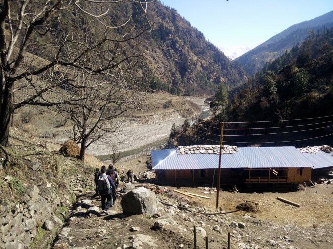
It was at taluka that our trek leader was supposed to brief us about the trek but all thrilled and excited we started the trek even before the trek leader could explain anything. The trail from the start was accompanied by Supin river on one side and mountains on another. As we went ahead the trail started getting greener and prettier. As our briefing was due we stopped after an hour of walking near the Supin river, where trek leader explained us about the details of trek, and raised our expectations with the stories about har ki dun. After half an hour of briefing and some rest we started to walk again.
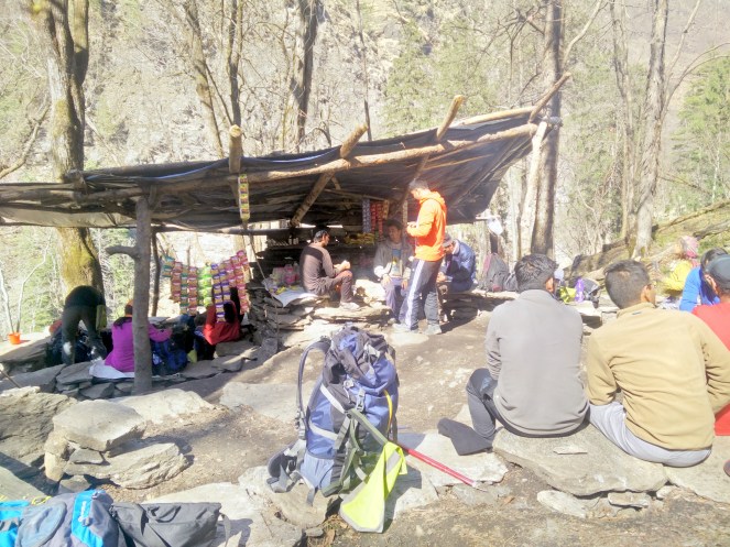

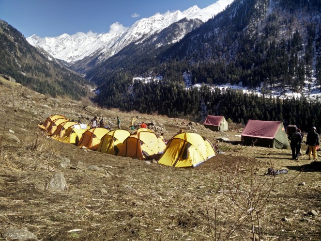
In the first day we had to cover a distance of 13 km till Puani Garaat but we gained an altitude of just around 600 meters. We started our climb at around 11:00 am hoping to reach the camp-site by 6. As we went on the trail kept getting beautiful, the calm river flowing on one side and the chirp of birds made us forget about the climb and we just kept on walking, and yes not to forget the Maggie shop which kept us energised. The trail to Puani Garaat is not very steep but there is a continuous uphill and downhill which can be tiring. During the trek dont forget to take a look at the pinkish apricot trees, and red coloured rhododendron. It was already 5 when we reached our first pitstop Puani Garaat. To our surprise all the tents and arrangement was already done by the trek staff and we were greeted with fresh lime water on reaching the camp. Although we were able to see snow clad mountains right from the start of the trek Puani Garaat gave us a much clearer view of the mountains which we all were waiting to jump upon. At such a height with no light pollution and stars so bright and clear we couldn’t resist our-self for some star gazing .

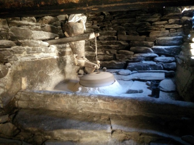
It was at 8:30 after packing our tents, sleeping bags and collecting lunch we left Puani Garaat for our next stop Kalkatiyadhar. As every place has a reason or story attached with its name so is the case with all the camp-sites. Puani Garaat is named after Puani which means “water” and Garaat is something which villagers use to grind. So Puani Garaat means a place where flowing water helps in the mill to grind wheat and which are still being used, and Kalkatiyadhar is derived from a mountain which is black.
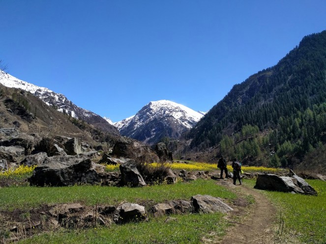
There are 2 trails from Puani Garaat which can take you to Kalkatiyadhar one is from Osla and another from Seema. Olsa is the last village on the trail as according to Indian government the high altitude region starts after a height of 9000 ft and no village can be build above this height. We prefered to go through Seema and visit Osla while coming back. On day 2 the trek covers a distance of 7 km, with an altitude gain of 206 m in 6 hours. The trail comprises mostly of level walks, a few hops across streams, meadow walks, a Maggie shop and a final ascent alongside the farms of Osla villagers where they have planted wheat and mustard and yes do look for some waterfalls as you climb. The night was again followed by some star gazing. As it was too cold and the breeze made it much chiller we started the bonfire and gathered around for dinner and some chit chat.
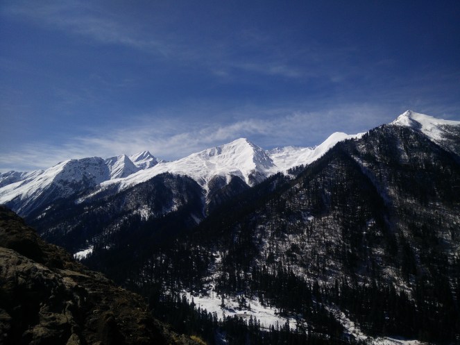
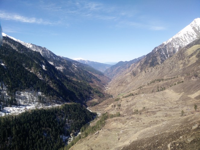
The last leg of our climb was till Har ki Dun which covers a distance of 4 km in 5 hours, taking you from 2,730 m to 3,587 m. The trail is initially ascending, followed by a descent and a final ascend. But due to a lot of snow we had to camp 1.5 km before the valley leaving the buffer day to explore the valley. It’s only when we took a U-turn around Kalkatiyadhar we were able to see Har ki Dun, to our surprise the Kedarkanta peak was also visible on the back side after the turn. The turn will takes you from beautiful meadows, village farms, alpine vegetation to spectacular valley view and breathtaking view of snow clad mountains. It was in the month of March that we visited Har ki Dun and so it was in the last leg of the trek we came in close to snow. Just after crossing the Kalkatiyadhar and meeting with snow we started the much awaited snow fight and by the time we reached the camp everyone was already tired not because of the climb but because of the tough fight between our teams. To our surprise there was enough vegetation present all around us and the oak trees covered with snow made it a more attractive view.
With a smile of satisfaction and sparkle in our eyes and snow all around us we went to sleep waiting to witness the valley that we all have came for.

Kalkatiya dhar is supposedly named by Bengali trekkers. The turn at this place gives amazing views across the valley. But climb to the highest point of this place ascends too quickly.
LikeLiked by 1 person